Yale Climate Connections, March 18th, 2021
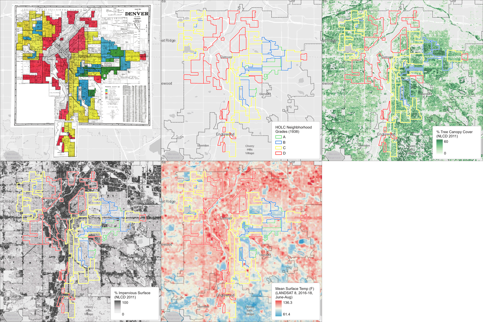
Maps of Denver show neighborhoods, outlined in red, that were once redlined. Today, such neighborhoods often have fewer trees and experience hotter temperatures in summer than other neighborhoods nearby. (Images credit: Groundwork Milwaukee)
Groundwork USA, a network of environmental justice organizations, is exploring the connection between formerly redlined neighborhoods and the climate crisis today. As part of its Climate Safe Neighborhoods initiative, Groundwork overlaid historic redlining maps from nine U.S. cities with data about tree cover, heat, and impervious surfaces such as asphalt and concrete. All of the maps discussed in this interview were made by Groundwork Milwaukee.


